
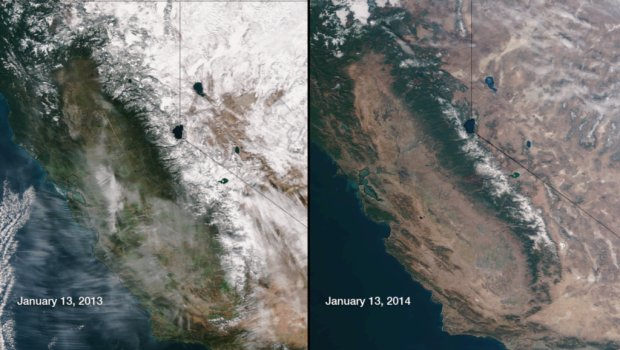
The National Oceanic and Atmospheric Administration (NOAA) released satellite photos this week that compared the snowpack in California exactly a year apart to the day.
On the left is Jan. 13, 2013 while 2014 is on the right. The difference is stark.
On Thursday, Santa Clara County learned that it had been designated a Drought Area.
Find out what's happening in Palo Altowith free, real-time updates from Patch.
Get more local news delivered straight to your inbox. Sign up for free Patch newsletters and alerts.
We’ve removed the ability to reply as we work to make improvements. Learn more here

